A 3D vp and vs tomography of Sao Miguel island / Azores
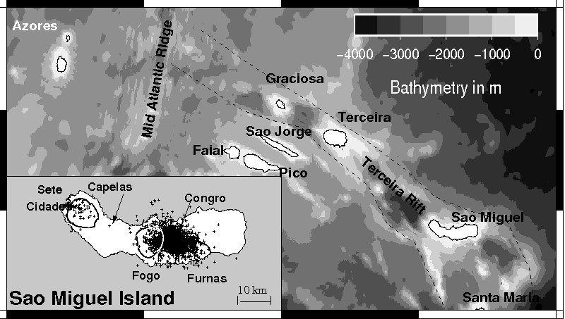
Sao Miguel Island is part of the Azores archipelago located in the central part of the Northern Atlantic. During the years 1998 to 2005 the local seismic network acquired travel time data from about 15400 seismic events in the island and its surroundings with a focus between the two volcanoes Furnas and Fogo, also known as Agua de Pau. The data were inverted for hypocenter and seismic velocities using the PSTOMO local earthquake tomography algorithm. The resolution test indicates robust results in a region comprising 50 km x 15 km x 12 km. For the first time it was possible to image the bottom of the crust and transition to the upper mantle in a depth of around 10 km. A high vp/vs-ratio region above a low vp/vs-ratio region in the area between Fogo and Furnas indicates a two-phase hydrothermal area reaching down to midcrustal depths and appears to be the main origin of seismicity. This study thus indicates that an increase in seismicity rate since 2002 seems to be unrelated to renewed volcanism. A high velocity anomaly in the northwest of the island might indicate an as yet unknown tectonic boundary between Sete Cidades volcano in the west of the island and the remaining part.
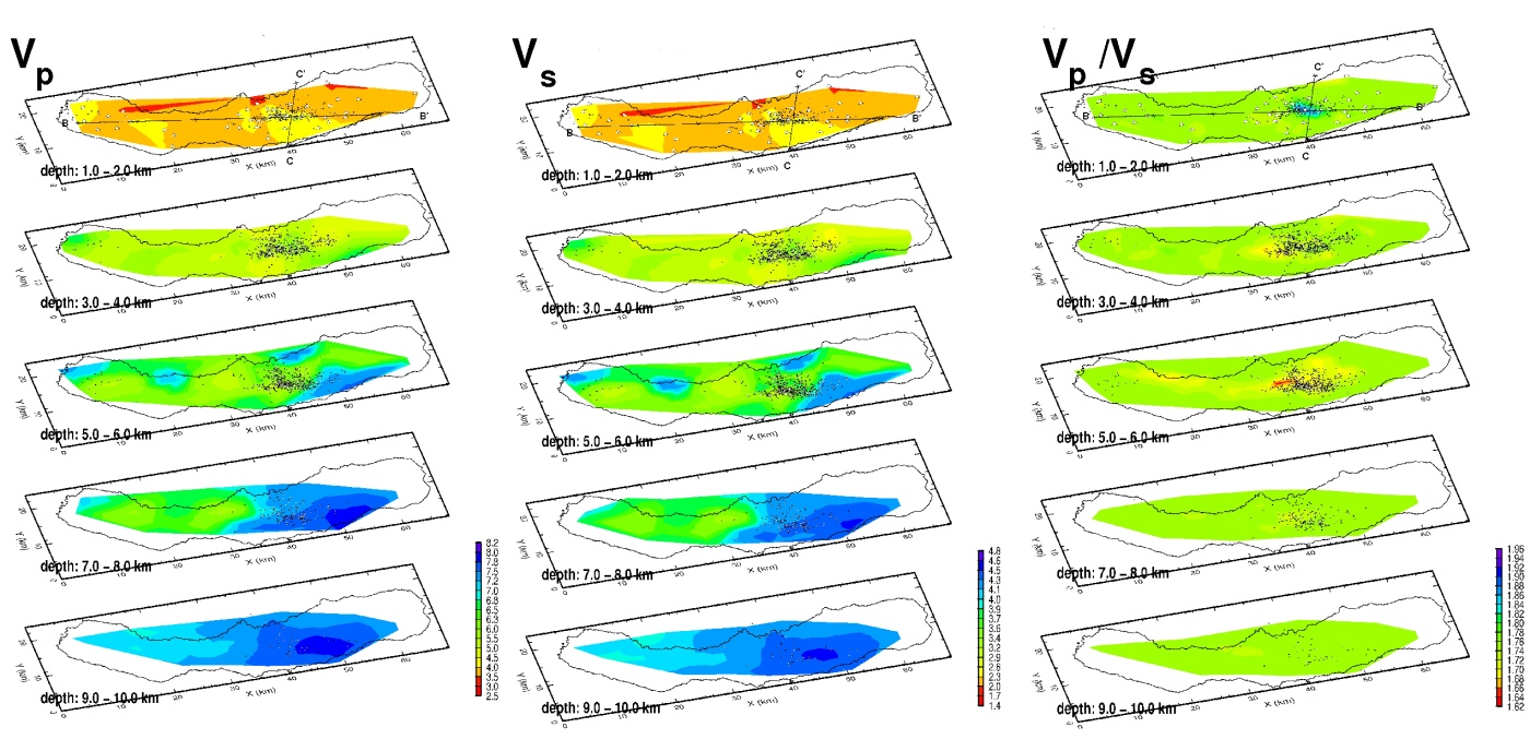
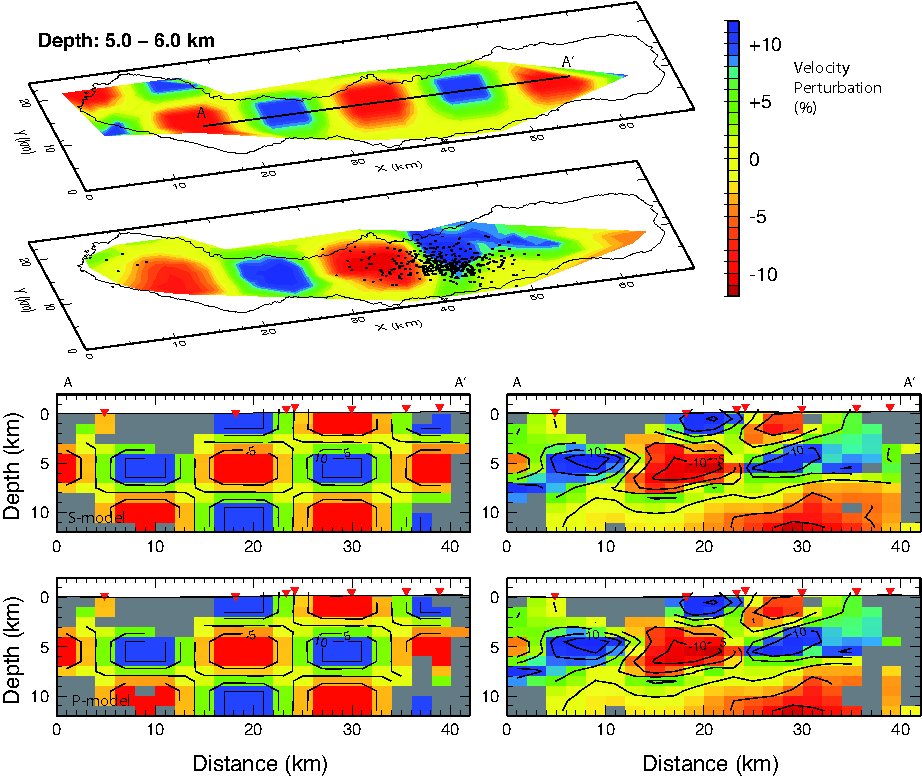
Figure 5: The inversion results for vp, vs and the according vp/vs ratio have been displayed.
Publications
Peer-reviewedC. Riedel, A. Tryggvason, D. Silveira, M. Escuer, N. Wallenstein (2009) A three-dimensional vp and vs local earthquake tomography of Sao Miguel island / Azores, submitted to Geophysical Journal International